Dokdo’s topography
Dokdo is a volcanic island formed by lava that erupted from about 2,000 meters underwater. It was formed about 2.5 to 4.6 million years ago, between the Tertiary Period and the early and late Pilocene Epoch. (Gyeongsangbukdo, 2010, Dokdo Series).
The parts of the island above sea level are only the peaks of a larger, underwater island. The entire island is a huge volcano, with the highest summit reaching approximately 2,300 meters, which is higher than Jeju’s Mt. Halla, and with an upper diameter of over 10 kilometers (Korea Institute of Ocean Science and Technology [KIOST] Dokdo Research Center). Between Seodo and Dongdo, there is a strait about 110 to 160 meters wide, about 330 meters long, and 5 to 10 meters deep. The waters near Seodo are shallower than those of Dongdo, where the depths of the waters just off the island plummet hundreds of meters (Daegu Local Ministry of Environment, 2013).

Dokdo’s submarine topography
< Sources: Ministry of Oceans and Fisheries, Dokdo Research Center at the KIOST East Sea Environment Research Division >
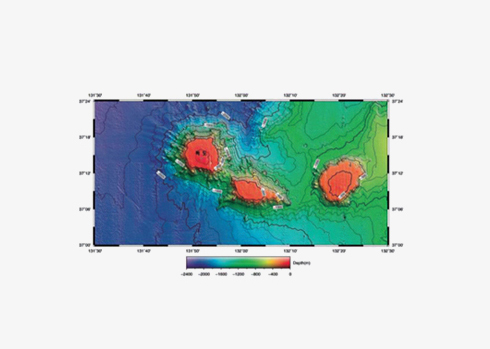
Submarine topography surrounding Dokdo with an isochore line of 13,100 meters
< Sources: National Geographic Information Institute (NGII), 2011 >
Scenery of Dokdo
Dokdo’s breathtaking scenery was created by varying degrees of erosion caused by the weathering of different types of bedrock, the inclination of stratum, waves, tides, littoral currents, tidal currents, and salinity. Dokdo has typical coastal features, weathering topography, volcanic landforms—similar to pillar-shaped joints—and bomb sags and fault lines. There are also dykes and talus (Gyeongsangbukdo, 2010, Dokdo Series).
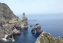
Seodo coastal topography <Photography by Kwon Jin-woo>
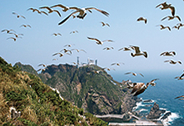
Dongdo coastal topography <Photography by Dan In-dong>
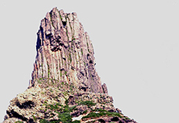
Columnar joints(volcanic topography) of Seodo`s Tanggeonbong <Photography by Kim Chul-hwan>
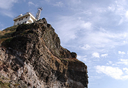
Bomb sag (volcanic topography) of Dongdo`s Eolgulbawi <Photography by Kwon Chul-hwan>
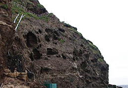
Taffoni(weathering topography) near the dock on Dongdo <Photography by Gyeongsangbukdo>
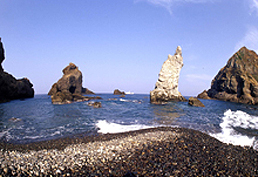
Seodo`s pebbled coast <Photography by Kwon Jong-gwon>
Reference
- Gyeongsangbukdo, 2010, Dokdo Series
- National Geographic Information Institute (NGII), 2011, Dokdo Jiriji, Ministry of Land, Transport, and Maritime Affairs, NGII
- Dokdo Research Center at KIOST (Korea Institute of Ocean Science and Technology) (www.kiost.ac)
- Daegu Local Ministry of Environment, 2012, 2012 Dokdo Ecosystem Monitoring Report
- Daegu Local Ministry of Environment, 2013, 2013 Dokdo Ecosystem Monitoring Report
- Ministry of Oceans and Fisheries, KIOST, East Sea Environment Research Division, Dokdo Research Center, Dokdo Information System (www.dokdo.re.kr)